Data Products
Customer Profile
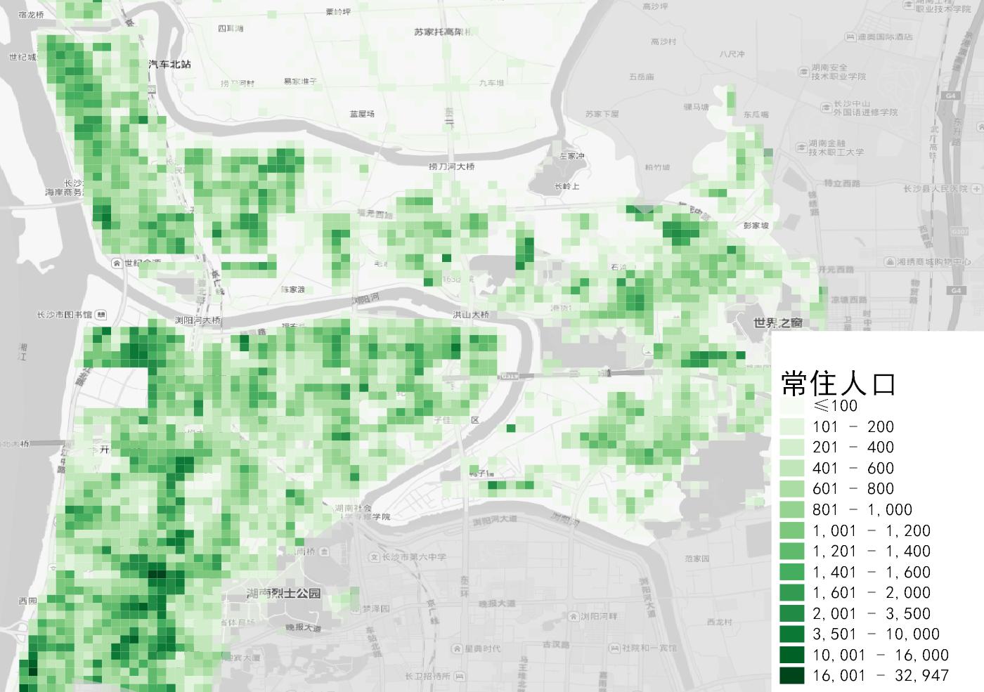
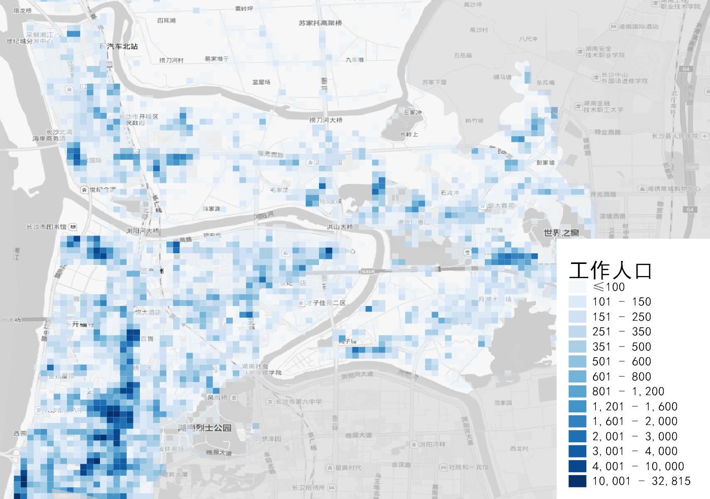
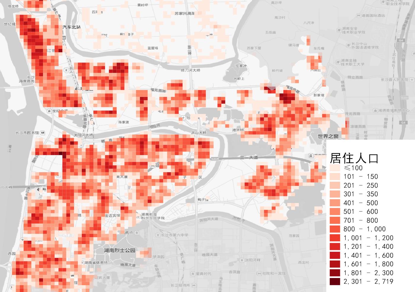
Population/passenger flow data, portrait data
Social economy
Population size, GDP, disposable income, consumption expenditure, total social retail sales, etc
Brand data
Restaurant, retail, pharmaceutical and other chain brand data
Political districts and borders
Administrative division, business area, AOI (functional side), geographic grid, postal code boundary
Public services and facilities
Hospitals, schools, scenic spots, hotels, transportation, etc
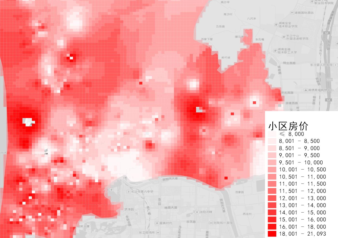
Real Estate Data
Commercial real estate, residential real estate, land auctions, etc
Industrial and commercial organizations
Company name, registered capital, date of establishment, number of insured, type of company, industry, etc
Base map